Finding Bridleways in England and Wales

JanS18

Active Member
Joined
24 July 2018
Messages
30
Visit site
Hello Everyone ?

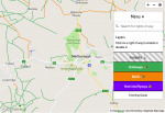
As an avid rider, I've long been frustrated by the lack of a good bridleway map, so I recently commissioned one, and have decided to make it completely free.

You can access it on this page: https://eventingguide.com/finding-bridleways-england-uk/

I welcome any feedback. Enjoy ??
 

Attachments

  • bridleway-map-eventingguide.png
    bridleway-map-eventingguide.png
    202.8 KB · Views: 38

JanS18

Active Member
Joined
24 July 2018
Messages
30
Visit site
Why not use Ordnance Survey? It’s the official ROW record.

Hi @cold_feet. Ordnance Survey isn't actually the official ROW record. Instead, definitive maps (held by local authorities and councils) are. What's more, many legally recognised rights of way are omitted from Ordnance Survey maps.

The map I've commissioned draws from literally hundreds of definitive maps, and is therefore more reliable than an OS data source.
 

iknowmyvalue

Well-Known Member
Joined
22 August 2016
Messages
1,337
Location
Lincolnshire
Visit site
Good tool!

You might want to check about public access to dismantled railway lines, there’s definitely one near me that is accessible to horses, and it isn’t on that map.
 

Fjord

Well-Known Member
Joined
19 July 2009
Messages
2,124
Visit site
That's handy, it's really interesting to look around the different areas. Agreed, if we could ride on even some footpaths it would join up so many routes.
 

JanS18

Active Member
Joined
24 July 2018
Messages
30
Visit site
Good tool OP. Frustrating when I look at my area how many bridlepaths could be linked up if we could use footpaths.
Definitely! It's worth looking into whether these sections should be designated as a bridleway. Broadly speaking, the process for doing this is to check historic maps (in my local area, the site http://www.kypwest.org.uk has several) for anything that suggests the route was once officially open to more than pedestrians, and reach out to your council's Right of Way Officer to see whether there's merit to your claim. The process can be time consuming, but shouldn't cost you anything, and is easier than you'd expect - particularly in cases where bridleways suddenly stop, or turn to footpaths.
 

JanS18

Active Member
Joined
24 July 2018
Messages
30
Visit site
Good tool!

You might want to check about public access to dismantled railway lines, there’s definitely one near me that is accessible to horses, and it isn’t on that map.

It would be great to add that information to the map. However, it's likely that the council doesn't have anything to do with access over the route, and therefore information would have to be sourced from third parties. It's on the phase two to-do list!
 

SEL

Well-Known Member
Joined
25 February 2016
Messages
12,456
Location
Buckinghamshire
Visit site
Definitely! It's worth looking into whether these sections should be designated as a bridleway. Broadly speaking, the process for doing this is to check historic maps (in my local area, the site http://www.kypwest.org.uk has several) for anything that suggests the route was once officially open to more than pedestrians, and reach out to your council's Right of Way Officer to see whether there's merit to your claim. The process can be time consuming, but shouldn't cost you anything, and is easier than you'd expect - particularly in cases where bridleways suddenly stop, or turn to footpaths.
Thanks. There's one that looks pretty obvious and I know a lady in her late 60s referred to riding over it 20 odd years ago but the gates are pedestrian only now. I'll see if I can find any reference to it ever being more than a footpath
 

JanS18

Active Member
Joined
24 July 2018
Messages
30
Visit site
Your original post stated your frustration at the lack of a good bridleway map which is exactly what I linked to. I’m sure somebody will find it useful.
Unfortunately, if you rely on that map you'll miss out on a lot of great rides! Thanks for sharing the link, anyway :)
 

forever broke

Well-Known Member
Joined
10 January 2013
Messages
178
Visit site
Thanks for this, OP, my friend and I have been trying to find new rides near us and were saying we needed something exactly like this! I've sent her the link and we'll be studying it for new routes.
 

Bernster

Well-Known Member
Joined
14 August 2011
Messages
8,045
Location
London
Visit site
What a great thing to do. I looked a while back and found it pretty difficult to see stuff, I tried OS maps, looked at the definitive map for my area, and something like rangeviewer or finder, can’t remember exactly. But I’m in the south east and it’s pretty built up so the bridleways are very limited.
 

criso

Coming over here & taking your jobs since 1900
Joined
18 September 2008
Messages
11,804
Location
London but horse is in Herts
Visit site
I think it's really helpful to have it laid out like this.

I've never got on with OS maps as they show all the different types of ROW in the same colour with different patterns to differentiate which makes it difficult to see routes at a glance. The local definitive map is OK and good for seeing detail but the way it refreshes as you zoom in and out is quite annoying.

I noticed it also links to the definitive map in my area if I want to investigate further

Other types of access like permissive routes would be nice but would be more difficult to maintain as they can be removed or changed to footpath at any time.
 

JanS18

Active Member
Joined
24 July 2018
Messages
30
Visit site
I think it's really helpful to have it laid out like this.

I've never got on with OS maps as they show all the different types of ROW in the same colour with different patterns to differentiate which makes it difficult to see routes at a glance. The local definitive map is OK and good for seeing detail but the way it refreshes as you zoom in and out is quite annoying.

I noticed it also links to the definitive map in my area if I want to investigate further

Other types of access like permissive routes would be nice but would be more difficult to maintain as they can be removed or changed to footpath at any time.

It would be great to add permissive routes! It's something I've got in mind for the second iteration.

Thanks for your support.
 

stangs

Well-Known Member
Joined
18 September 2021
Messages
2,707
Visit site
What an amazing resource, thank you!

Out of curiosity, how will the second iteration be done? It sounds like an even greater undertaking.
 

southerncomfort

Well-Known Member
Joined
29 September 2013
Messages
5,279
Visit site
I think it's really helpful to have it laid out like this.

I've never got on with OS maps as they show all the different types of ROW in the same colour with different patterns to differentiate which makes it difficult to see routes at a glance. The local definitive map is OK and good for seeing detail but the way it refreshes as you zoom in and out is quite annoying.

I noticed it also links to the definitive map in my area if I want to investigate further

Other types of access like permissive routes would be nice but would be more difficult to maintain as they can be removed or changed to footpath at any time.

I find the same regarding OS maps, they can be a bit confusing and as the OP says they don't always show all ROW.

I've always been a bit unsure of which byways we're allowed to ride on, so i think this will be super useful.

Eta: my area (Kirklees) isn't on there. ☹️
 

ahml100

Well-Known Member
Joined
8 December 2012
Messages
427
Location
Oxon
Visit site
This is fantastic! Thank you so much, moving to a new area so it lovely to go in with some knowledge of where I can go. Quick Q, is there a way to change to imagery to satellite picture?
 
Top