Mobile phones and apps for hacking

PeterNatt

Well-Known Member
Joined
15 July 2003
Messages
4,547
Location
London and Hertfordshire
s68.photobucket.com
I went out for a nice long four and a half hour hack today and somehow got lost and did not get to where I wanted to go. What I would like to know is are there any apps that show you where you are using the ordnance survey maps. At present I have a very ancient mobile phone. What would be the best mobile phone for this app (with lots of long lasting battery power)? Many thanks.
 

spookypony

Well-Known Member
Joined
26 November 2008
Messages
7,339
Location
Austria
Visit site
Most apps I know link with Google Maps, not OS. Maybe if you have your OS map along in a map case, you could compare that with Google Maps if you are having trouble orientating yourself by the OS map alone?
 

phizz4

Well-Known Member
Joined
15 June 2017
Messages
454
Visit site
You can get a free app for Android and Apple phones that will give you a 6 or 8 or 10 figure map reference for where you are, but that is only useful if you have the OS map with you. Viewranger has a free App but you then pay for the maps. You can buy 'tiles' of anywhere in the country, so just buy the ones for your local hacking area, or you can buy packs, such as all of the National Parks at 1:50, 000 scale, which used to be £10. Or, buy the whole of the UK at 1:50,000. The big advantage is that once you have downloaded the maps to your phone you don't need internet access to find your location. your location is shown on the OS map, so you only need the phone GPS to see enough satellites.
 

JFTDWS

Well-Known Member
Joined
4 November 2010
Messages
20,984
Visit site
Or if you buy the Land Rover Explore, you get a subscription to ViewRanger anyway, so you get a phone with decent GPS/battery (+/- additional battery pack), and OS maps wherever you are in the UK.

Or, if you don't want a new phone, you just pay the £25? annual subs to VR, which might be cheaper ;)
 

ester

Not slacking multitasking
Joined
31 December 2008
Messages
60,284
Location
Cambridge
Visit site
I use viewranger, it’s much nicer than the OS app. You get free downloads now for OS maps but I’ve ended up buying the tiles on viewranger. It has always pinpointed me very well regardless of signal -which was very handy on private woods with lots of keep out signs to make sure you were on the bridleway

Also useful for planning routes or recording then going back to do the same 6 months later.

Currently using for cycle tracking not nearly as much fun.
 

Brownmare

Well-Known Member
Joined
5 May 2010
Messages
1,629
Visit site
I can recommend viewranger too. I have used it for years with the OS maps for riding and hiking.
 

Tiddlypom

Carries on creakily
Joined
17 July 2013
Messages
22,373
Location
In between the Midlands and the North
Visit site
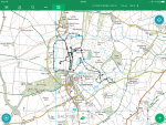
Another Viewranger user and fan here. I started by buying the individual map tiles as necessary, but then I got three years full access to all the UK OS Landranger and Explorer maps for a subscription of £50.

You can always see your current location which will be in the centre of the cross hairs. It's nice to keep a record of the trip for posterity, too.

This is the ground we covered on foot at Badminton 2018 :).

image.png
ETA I use an older iphone, a 5s.
 
Last edited:

ester

Not slacking multitasking
Joined
31 December 2008
Messages
60,284
Location
Cambridge
Visit site
The only thing that bugs me about it is having a + for the zoom and a + for the record etc menu. I always forget when I haven't used it for a while!
 

Follysmum

Well-Known Member
Joined
15 February 2013
Messages
2,444
Visit site
View ranger definitely in my opinion is the best and I have tried most.

I love the confidence knowing wherever I am I can always find my way back as you always know where you are. Also has the added feature of buddy beacon so hubby knows where I am and it anything happens he can find me.
 
Top